
Results
Exemplary results conducted with the MODAM approach and/or MODAM tool box
MODAM is mainly oriented towards application in a regional context as the advantages of the modelling approach depend much on data availability and the possibility to make a difference with respect to production activities and their potential ecological impacts.
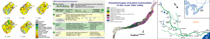
- The approach has been developed in the context of the dissertations of Harald Kächele, Andreas Meyer-Aurich and Peter Zander and was initially applied in the conservation reserve Lower Oder Valley and in the Schorfheide-Chorin bioshere reserve and then in the context of the GRANO project.
- The approach has recently been applied in seven European regions in the context of the EU FP6 project MEA-Scope: see www.mea-scope.eu
- an application based on FADN based farm typologies for Brandenburg is currently elaborated.
Typically the application of MODAM is based on evaluated production activities. Please, refer to EIA-Results for examples of results of the environmental ecaluation based on the fuzzy tool.
The integration of ecological evaluation results within the decision making model allows for policy driven scenarios which are based on alternative policy instruments as well as for goal driven scenarios. Goal driven scenarios are based on environmental targets which are build in as restrictions, and so 'enforce' the farmer to achieve a certain level of environmental objectives. The graphical user interface then allows the quick production of numerous trade-off functions.
The spatial reference of results may be direct or indirect. Direct spatial reference means that individual fields are represented in the model and results can directly be transferred to a geographical information system link. Indirect spatial reference refers to different options to regionalise representative fields or agro-environmental zones to specific spatial references. Landuse maps of the research area can be used as graphical display of changes in landuse patterns in different scenarios calculated by the model.
