Field Trip 2
Hydromorphic soils cover about 44% of the area in the federal state of Brandenburg region. They are principally used as grassland and, hence, affected by drainage and cultivation. Local climate trends intensify the importance of these soils according to their native functionality of carbon and water retention.
The field trip exposes the participants to different hydromorphic soils and types of grassland uses in Brandenburg.The destination of the field trip is the region of Barnim, about 50 km North of Berlin. Due to glacial genesis, these soils show a large heterogeneity. Structurally, land use is dominated by large farms producing animal feeds and bio-energy. Precipitation is about 500 mm per year, which is less than the nationwide average.
Extensive pasture on Gleysols
The 250 ha large lowland is used as an extensive pasture since 1990. From May to October the cattle is fed on the meadows by regular turnover. In addition single parts of the lowland are mowed for hay production. The mean summer water table reaches 40 cm below surface and vegetation is dominated by Lolium perenne. Energy content of the growth certainly depends on time of harvest but reaches 6.34 MJ NEL per kg dry matter.
Native fen soils - the kettle hole mire Diebelsee
The Diebelsee is located in the north east of Brandenburg, within the UNESCO Man Biosphere Reserve „Schorfheide-Chorin“. Its surface area amounts to approximately 0.14 km2. The lake was created in the last glacial period (Weichselian; 110,000 to 10,000 BP) by the Scandinavian ice sheets amongst many other depressions in the north-eastern part of Germany. The Diebelsee itself is a kettle hole mire and was formed by a large ice block that separated from the retreating glaciers. The oldest peat found in the mire is dated 13,000 BP (deposition of volcanic material: Laacher See Tephra) and was found 13.5 m below today’s lake level.
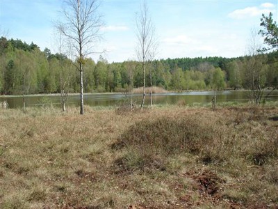
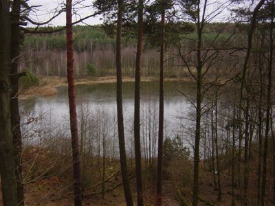
The kettle hole mire Diebelsee is part of the Biosphere Reserve Schorfheide-Chorin (pictures spring 2007)