
Risk of Groundwater Pollution
Land use maps 4
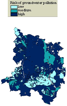
The risk of groundwater pollution is then assessed for the whole area using site specific data like soil properties, slope, annual rainfall etc.
MODAM is hosted by the
Institute of Socio-Economics
at ![]() Leibniz Centre for Agricultural
Landscape Research
Leibniz Centre for Agricultural
Landscape Research
The Plone® CMS — Open Source Content Management System is © 2000-2021 by the Plone Foundation et al.
Plone® and the Plone logo are registered trademarks of the Plone Foundation. Distributed under the GNU GPL license.

 Previous:
Index of Goal Attainment (IGA)
Previous:
Index of Goal Attainment (IGA)
